🗻 Greater Northern Loop - Day 8
⛺️ An early departure from Cataract Valley. ⛰ The sun breaks through the clouds at Yellowstone Cliffs 🌬 Hardly any wind at Windy Gap. ☱ No swimming in Lake James. ⛺ Fire Creek is nothing to write home about.

| Date | Start | End | Trip 🚶miles | Today's 🚶miles |
|---|---|---|---|---|
| 2018-08-24 | Cataract Valley | Fire Creek | 41.5 | 13.6 |
⛺️ Cataract Valley
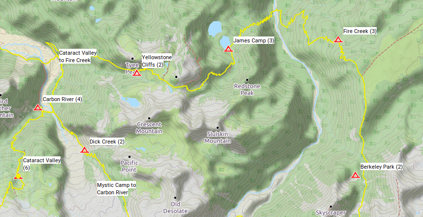
Today's a big day: 13.6 miles and ~5,000 of elevation gain ⬆ and loss ⬇. First down to the Carbon River recrossing the swing bridge, then up to Windy Pass just past the Yellowstone Cliffs. Then down again to the West Fork of the White River, which may or may not, have a bridge. And finally up again to Fire Creek for the night.
I'm rising early so that I have a full day for the longer distance and greater elevation gain and loss. Meanwhile, Casper and Tatyanna are sleeping in at Mowich Lake. They will be packing up camp, drive to the Sunrise Trailhead and hike into the Sunrise Campground a little over a mile from the trailhead.
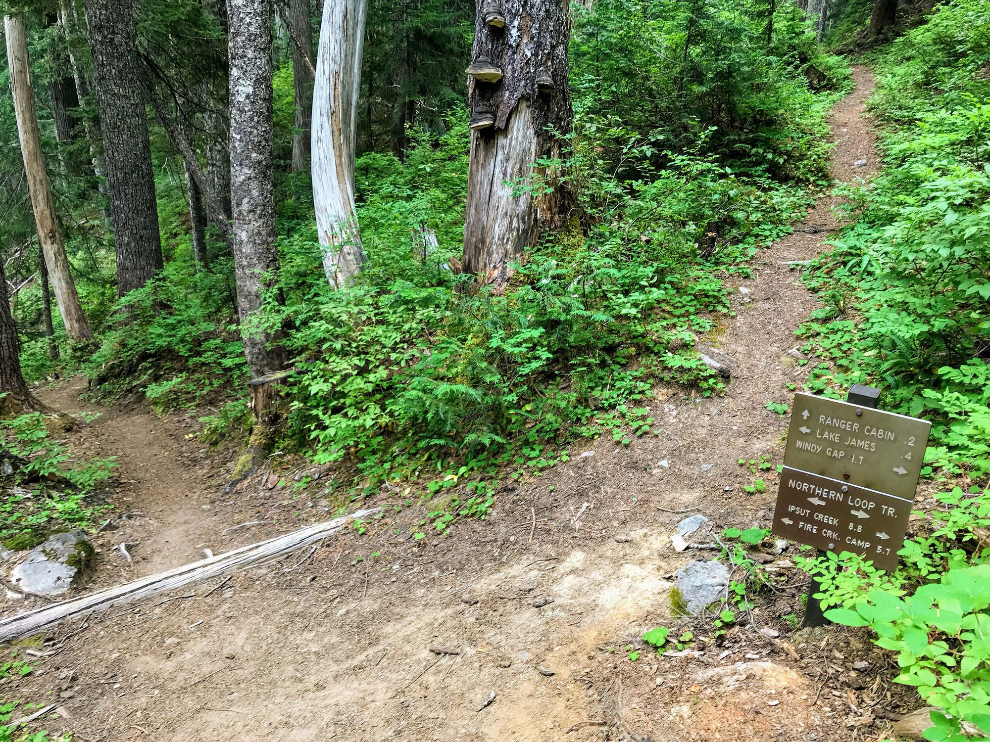
I'm cruising past Carbon River camp where we camped a few days ago, recross the Carbon River swing bridge for the 3rd time and before long I'm back at the junction to Yellowstone Cliffs. This is the start of a 2,920 ft climb to Windy Gap. The grade is excellent and I maintain a climbing speed of 1,800 ft/hr.
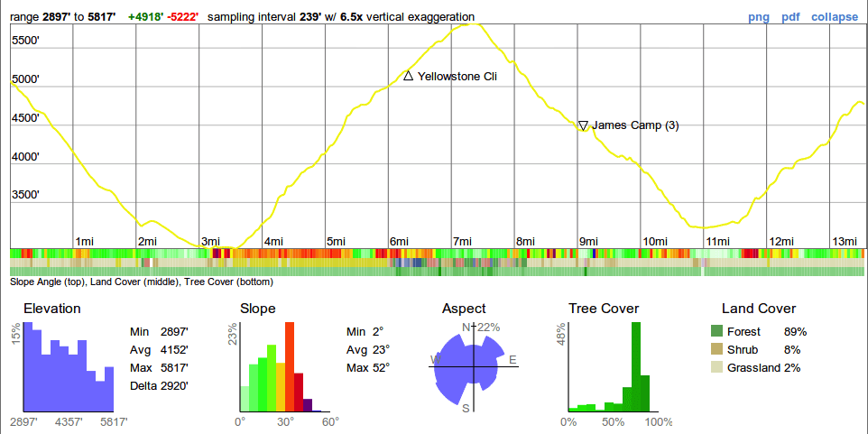
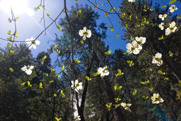
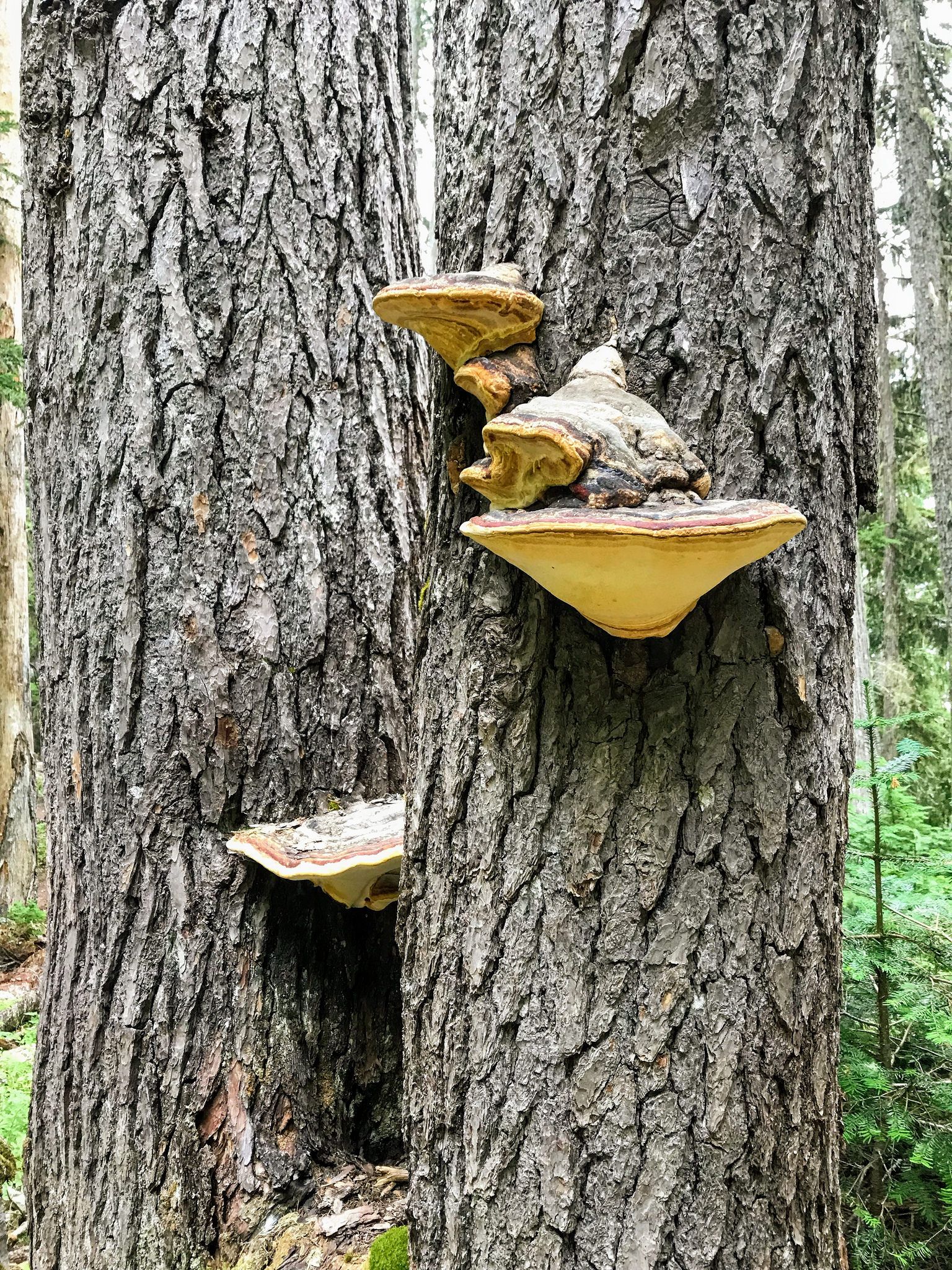
The first hour through a deciduous forest with little to no views. The trees shrink in height as I gain elevation and my surroundings become more alpine. The clouds begin to lift just as I enter a meadow and pass a side trail that descends to the Yellowstone Cliffs campsites.
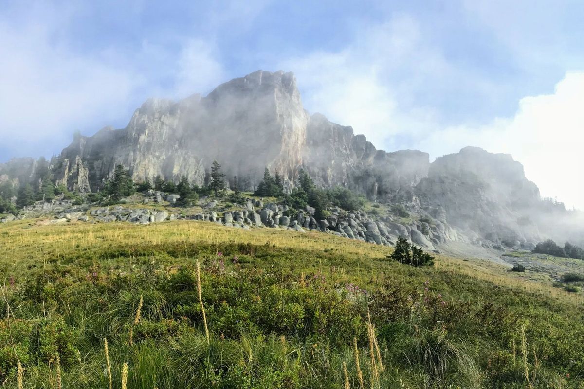
⛰ Yellowstone Cliffs
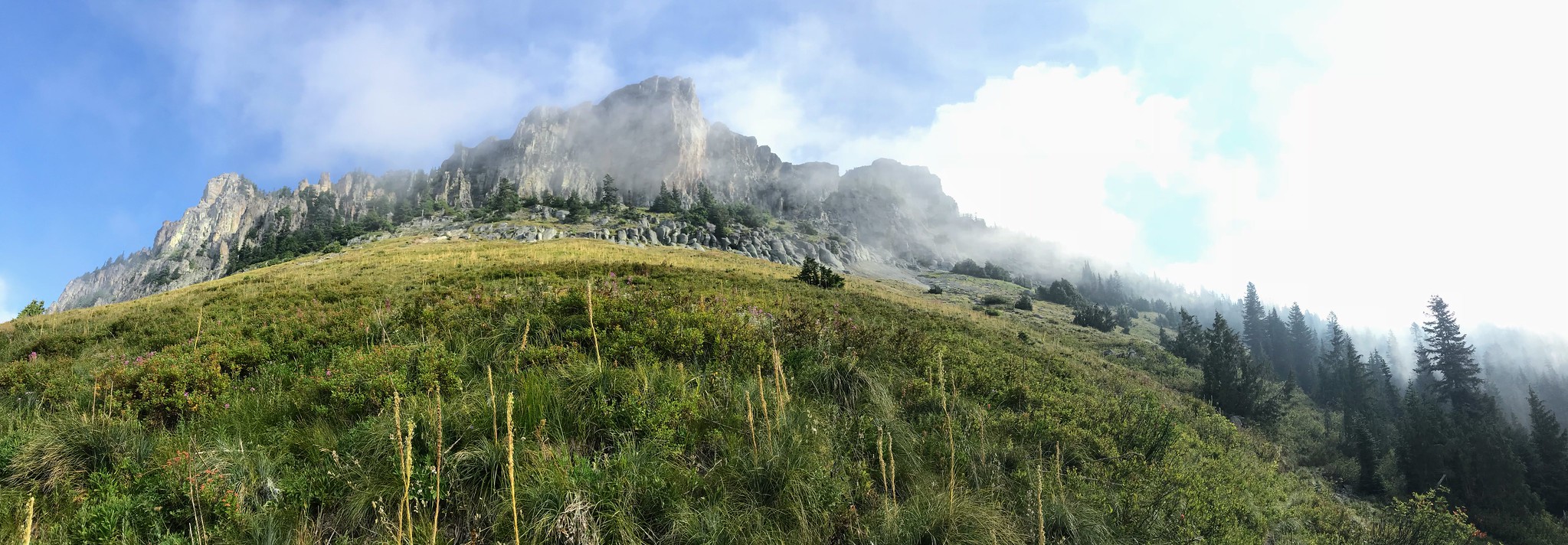
I take a snack break when the lifting clouds reveal the Yellowstone cliffs above me. I'm soaking in my beautiful surrounding as I enjoy a bar and some water.
🌬 Windy Gap
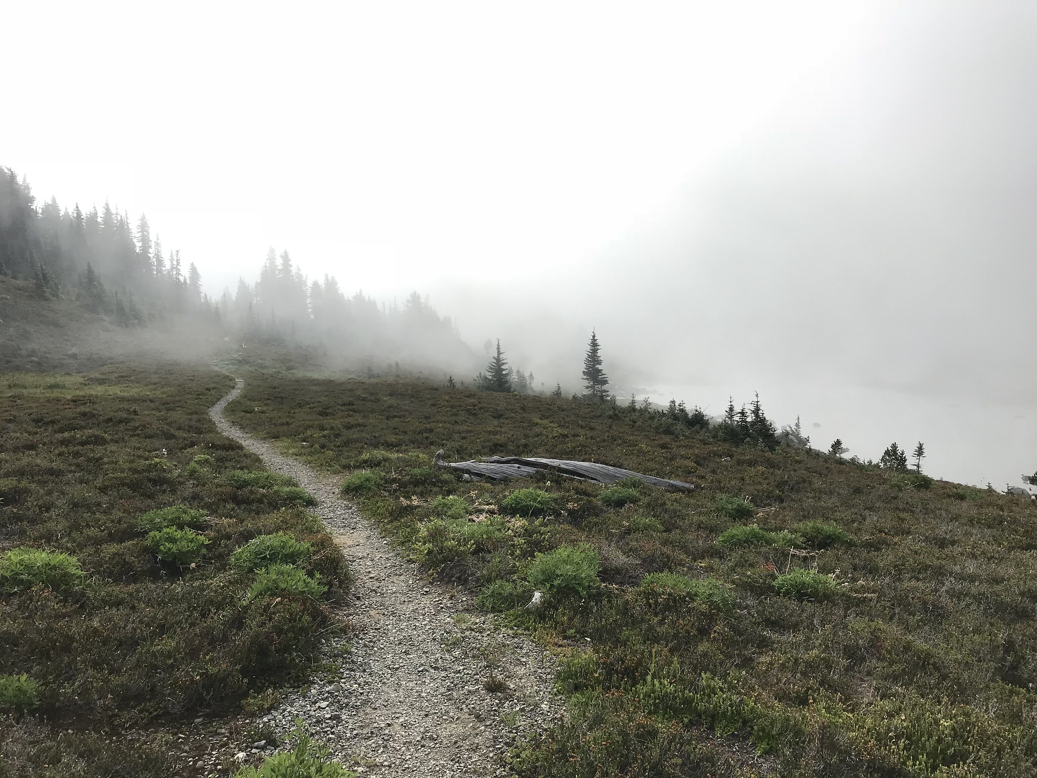
Not long after resuming the climb, I come upon Windy Gap, which didn't live up to its name at the time.
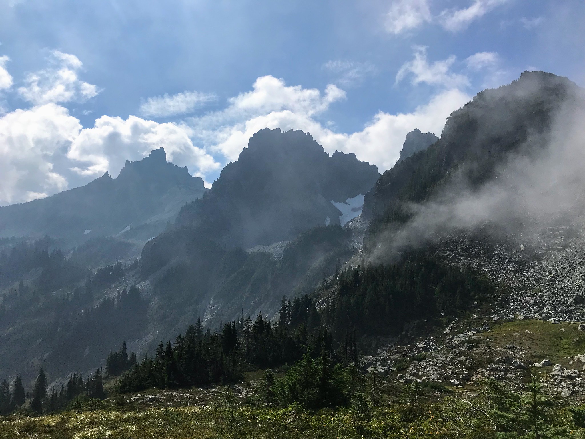
The clouds continue to dissolve and reveal the jagged peaks of the Sluiskin Mountains. From the Windy Gap pass, the trail winds down to Lake James where there are another 3 campsites. Soon, I'm among the trees again. I come across my first hiker of the day as I enter the forest.
☱ Lake James
Lake James is pretty but has an overgrown shore, which doesn't make for a nice resting spot. So I continue my descent to the West Fork of the White River and take a break at the last spot to filter water where the Van Horn Creek flows into the White River. All the glacial sediment of the White River would quickly clog a water filter, whereas the water of the Van Horn Creek is crystal clear.
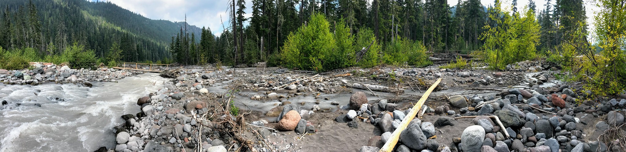
Stocked up on water, I'm ready to cross the West fork of the White River and the ensuing 1,600 ft climb to the Fire Creek campsites. A month earlier, a hiker died while crossing the river when there was no bridge. It is unclear whether a trail crew has built a new (seasonal) bridge. I'm keen to find out what the crossing looks like.
Steps before I reach the crossing, two women traveling in the opposite direction report that bridges are in place. The trail weaves between the river's braids as it connects bridges or logs across them. This crossing we've been warned about time and again, turns out to be a piece of cake.
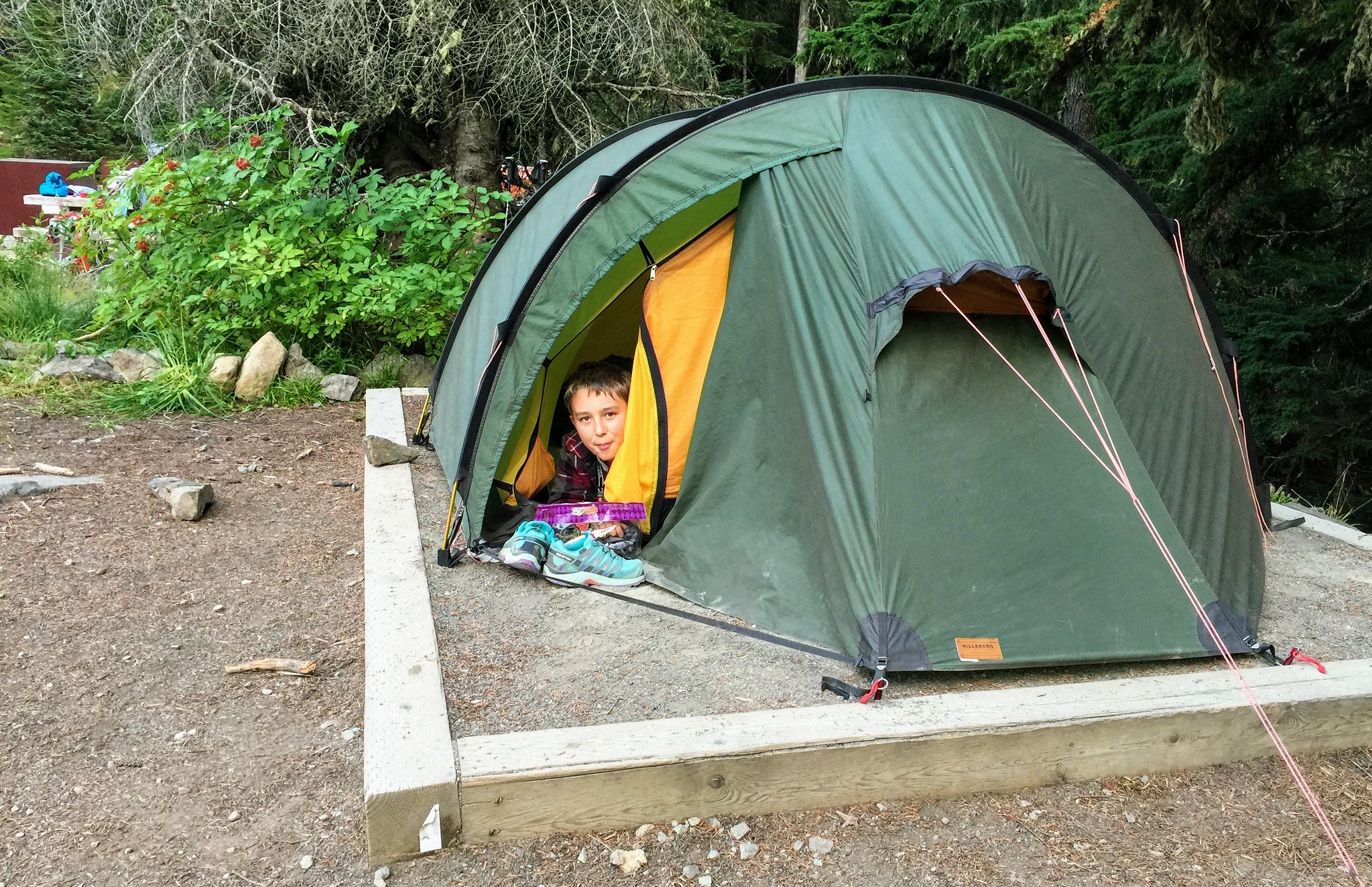
⛺ Fire Creek
The climb to Fire Creek that follows is rather boring. I "catch" an older couple at the junction to Fire Creek where I turn left to hike the 0.4 miles to the campsites. To my surprise, I'm alone at Fire Creek for the night. Not that I can recommend these sites, I found Fire Creek just as unappealing as Eagles Roost.
One more day to go. 🚶